Top 10 Sellers
-
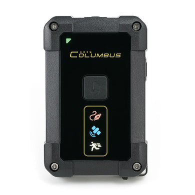
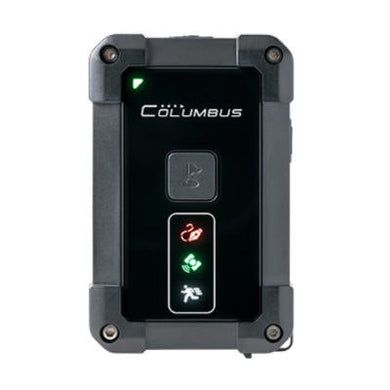
Columbus P-10 Pro Submeter (0.5m) GPS/GNSS Data Logger and USB Receiver
![Columbus P-10 Pro Submeter (0.5m) GPS/GNSS Data Logger and USB Receiver]()
- Regular price
- $299.00
- Regular price
-
- Sale price
- $299.00
- Unit price
- per
- Availability
- Sold out
-
TOP608BT High Precision USB / Bluetooth GNSS Receiver (ZED-F9P multi-band RTK, 30 cm accuracy standalone, up to 1.4 cm accuracy with RTK)
![TOP608BT High Precision USB / Bluetooth GNSS Receiver (ZED-F9P multi-band RTK, 30 cm accuracy standalone, up to 1.4 cm accuracy with RTK)]()
- Regular price
- $749.00
- Regular price
-
- Sale price
- $749.00
- Unit price
- per
- Availability
- Sold out
-
Columbus P-7 Pro Submeter (0.5 meter accuracy) USB and Bluetooth GNSS Receiver
![Columbus P-7 Pro Submeter (0.5 meter accuracy) USB and Bluetooth GNSS Receiver]()
- Regular price
- $199.00
- Regular price
-
- Sale price
- $199.00
- Unit price
- per
- Availability
- Sold out
-
Columbus P-9 Race Precision GNSS Receiver for Professional Racing (25Hz Update Rate, Meter-Level Accuracy, Dual-Mode Bluetooth)
![Columbus P-9 Race Precision GNSS Receiver for Professional Racing (25Hz Update Rate, Meter-Level Accuracy, Dual-Mode Bluetooth)]()
- Regular price
- $239.00
- Regular price
-
- Sale price
- $239.00
- Unit price
- per
- Availability
- Sold out
-
i-gotU GT-120B GPS / GNSS Data Logger - Water Resistant, 21g only, Managing Large Deployments with Ease (2022 Edition)
![i-gotU GT-120B GPS / GNSS Data Logger - Water Resistant, 21g only, Managing Large Deployments with Ease (2022 Edition)]()
- Regular price
- $104.95
- Regular price
-
- Sale price
- $104.95
- Unit price
- per
- Availability
- Sold out
-
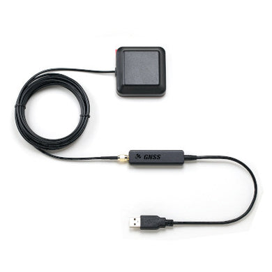
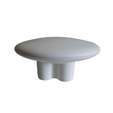
Columbus V-800(Mark III) multi-constellation usb GNSS receiver (1-10Hz, 2.0 meters accuracy)
![Compatible with Windows 10, Windows location sensor, MacOS, Linux, Android, Raspberry PI. 1. Horizontal position accuracy: 2.0m/CEP (50%), 8.0m/CEP (95%) 2. multi-constellation systems: GPS, GLONASS and Beidou, ensuring fast speed positioning ability in any area. 3. Supports up to 10Hz refresh rate]()
- Regular price
- $69.95
- Regular price
-
- Sale price
- $69.95
- Unit price
- per
- Availability
- Sold out
-
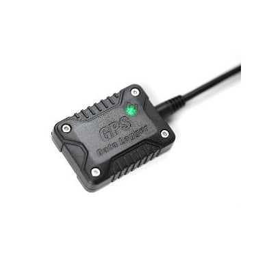
Navisys GR-9029 cm-level accuracy RTK GNSS data logger (Bluetooth BLE V5.2, rechargeable battery, IPX7 waterproof, Includes Data Logging Apps for iOS and Android, Location Sharing Feature for Android)
![Navisys GR-9029 cm-level accuracy RTK GNSS data logger (Bluetooth BLE V5.2, rechargeable battery, IPX7 waterproof, Includes Data Logging Apps for iOS and Android, Location Sharing Feature for Android)]()
- Regular price
- $799.00
- Regular price
-
- Sale price
- $799.00
- Unit price
- per
- Availability
- Sold out
-
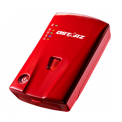
Qstarz BL-1000GT 10HZ Racing Recorder (GPS/GNSS, Bluetooth BLE 4.0, IOS / Android APPs & PC Software Included)
![Qstarz BL-1000GT 10HZ Racing Recorder (GPS/GNSS, Bluetooth BLE 4.0, IOS / Android APPs & PC Software Included)]()
- Regular price
- $319.00
- Regular price
-
- Sale price
- $319.00
- Unit price
- per
- Availability
- Sold out
-
Columbus P-1 Mark II 10Hz Professional GNSS Data Logger
![Columbus P-1 Mark II 10Hz Professional GNSS Data Logger]()
- Regular price
- $179.00
- Regular price
-
- Sale price
- $179.00
- Unit price
- per
- Availability
- Sold out
-
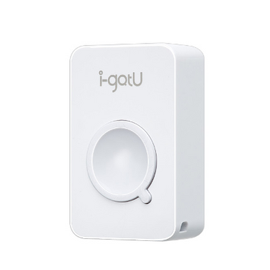
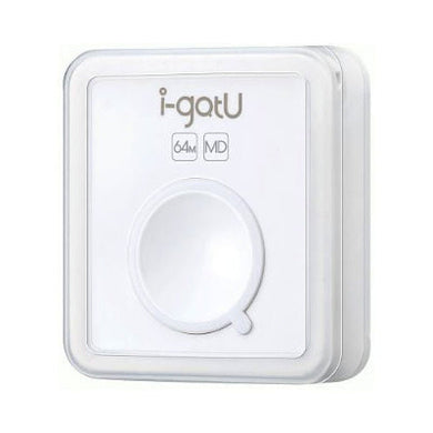
i-gotU GT-600B GPS / GNSS Data Logger - Water Resistant, Motion Sensor, 33g only, Managing Large Deployments with Ease (2022 Edition)
![i-gotU GT-600 Travel & Sports GPS Data Logger]()
- Regular price
- $134.95
- Regular price
-
- Sale price
- $134.95
- Unit price
- per
- Availability
- Sold out


GPS / GNSS Categories
RTK GNSS Categories
Product Categories by Utilization Purposes
Fast Shipping


Canada-Wide Shipping
C$8.99/Per shipment - Flat Rate
Arrives in 1-5 business days. Tracking number included.
Overnight shipping options available.
International Shipping (40+ countries)
C$12.99/per shipment - Flat rate
Arrives in 2-3 weeks. Tracking number included.
Faster shipping options available.